During the time of pandemic, GISCorps —group of volunteers who contribute in spatial data creation for humanitarian cause — developed interesting crowdsourced applications and web-mapping applications. These included allowing users to find vaccination sites based on where they live, identify grocery stores that practice social distancing and follow the safety protocol as well as report those that don’t adhere to the guidelines.
Below are some interesting applications developed by GIS Corps:
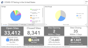
Here is an example of COVID-19 testing sites, type of site such as drive-through or not and the type of test that is offered.
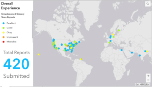
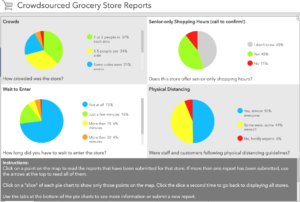
Here is another example of a crowdsourced app on safety and 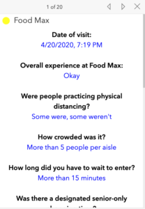 customer experience at grocery stores during the pandemic. This is how users can report their overall experience and alert other consumers about the safety protocols followed by the store, waiting time, and information that would help other consumers make a decision about visiting a particular store.
Additional examples of the apps related to COVID-19 can be found here.