This page consists of some creative projects I have undertaken as they have the potential to inform policy
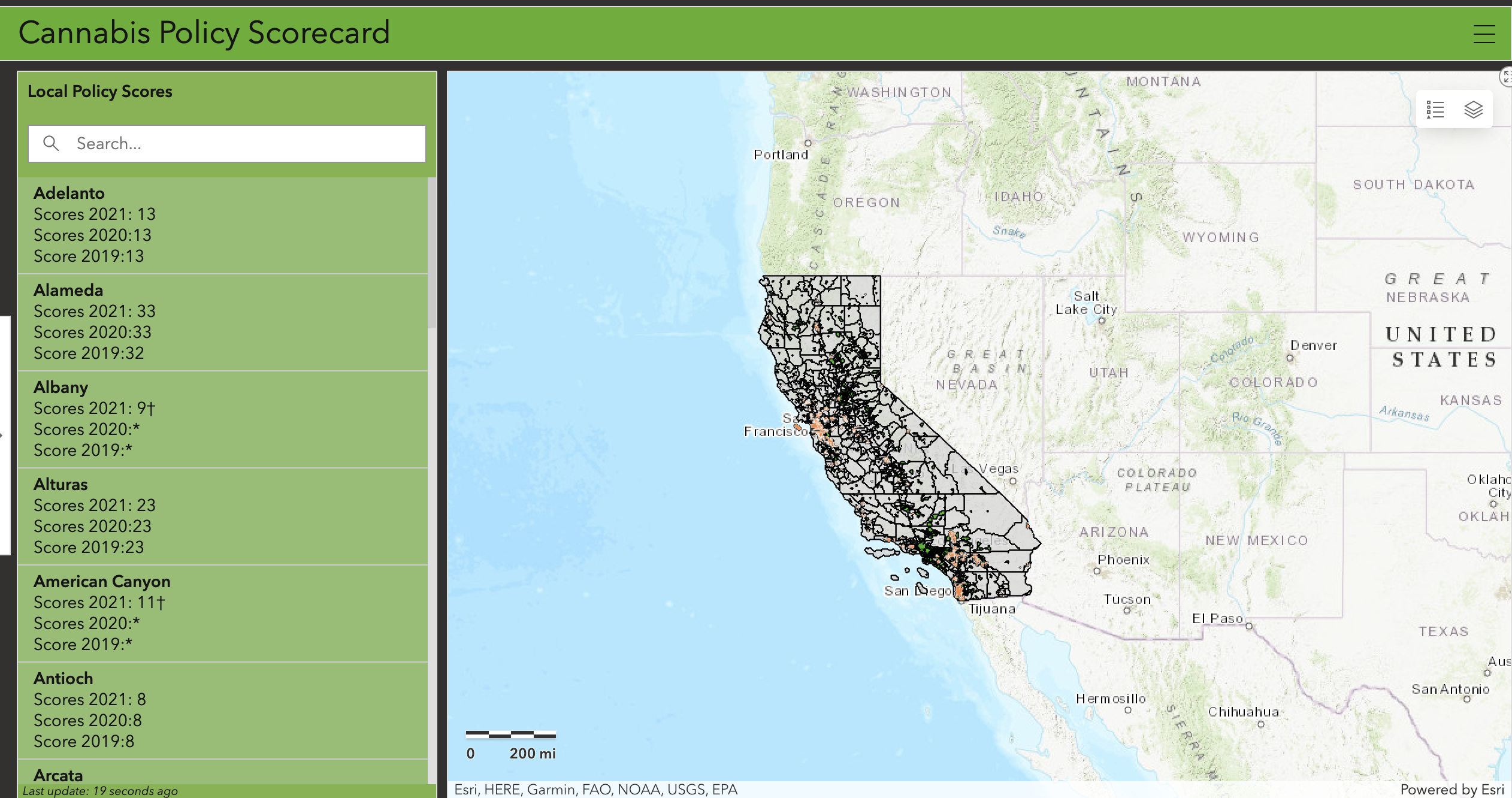
Cannabis Dashboard: This project uses publicly available data from Public Health Institute on local policy scores for various jurisdictions in California based on how favorable the cannabis regulation laws are to promote public health. The pdfs were converted into web-based dashboard for various stakeholders to interact and explore the data. The purpose of the dashboard is to identify places with stricter laws and areas where policy and advocacy efforts can be strengthened.
Tobacco-free pharmacy: This web map was created for the San Francisco Tobacco Free Coalition to support their policy and advocacy efforts related to not allowing tobacco sales in pharmacies.
Global Tobacco Surveillance Web App: This project used data from Demographic and Health Survey, Multiple Indicator Cluster Survey, and Global Adult Tobacco Survey to identify countries where key tobacco related indicators were collected and the years when the survey was conducted. The goal was to identify whether there was duplication of resources in terms of data collection and whether the surveys were consistent in how the key indicators were measured. Since low and middle income countries have fewer resources for monitoring and surveillance, identifying countries based on the frequency of the surveys that were collected and overlap between multiple survey agencies can reveal places with consistent data collection and places with gaps in coverage of tobacco-related indicators. This can provide understanding to policymakers, researchers, and stakeholders on need to strengthen the global framework for cross-country and within country comparison and prevent duplication of resources.
This project was done in collaboration with Stella Bialous at the University of California, San Francisco.
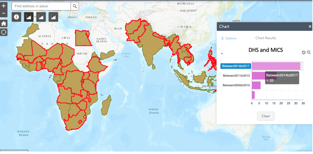
Countries where both Demographic and Health Survey and Multiple Indicator Cluster Surveys were implemented between 2014 and 2017
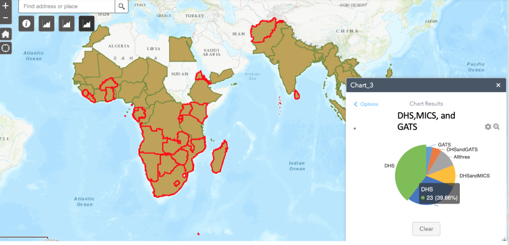
Countries where Demographic and Health Survey, Multiple Indicator Cluster Survey and Global Adult Tobacco Surveys were implemented. This can help identify countries where key tobacco related indicators were collected to facilitate cross-country comparison of tobacco use.
Op-ed in Mint newspaper:
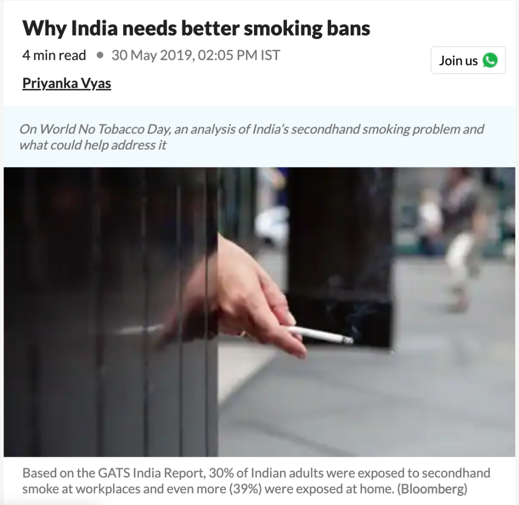
https://www.livemint.com/news/india/why-india-needs-better-smoking-bans-1559204159271.html#google_vignette
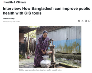
Interview with Mohammed Arju, Daily Sun:
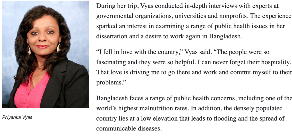
“Well, technology can help us be better informed, but it cannot by itself solve all problems. So the first thing would be expanding training and basic understanding of the use of GIS-based tools in public sector for informed decision making. This can help officials, who may not be located in the Health Ministry, but serving local level government agencies or health centers also understand and appreciate the purpose of such tools.” ~ Priyanka Vyas
https://www.daily-sun.com/post/153248/Interview:-How-Bangladesh-can-improve-public-health-with-GIS-tools
Media coverage of research study on UT Dallas news
Study Tackles Public Health in Bangladesh Using Geospatial Tools
https://news.utdallas.edu/social-sciences/study-tackles-public-health-in-bangladesh-using-ge/
Op-ed in business line newspaper
Health and GIS datasets for Global Health Researchers:
Interested in finding a health and a GIS dataset for global health research? Below are some web-maps prepared for the Center for Geospatial Research for Global Health Policy to assist researchers. Click on any icon to find out about the data for that location.
Countries for which Demographic and Health Surveys have been conducted, based on the number of years for which survey is available and the countries for which most recent survey period is available. To learn more, click on any location symbol on the map
Site Locations for the Health And Demographic Surveillance System maintained by the INDEPTH NETWORK based on the population covered. To learn more, click on a location symbol of your choice.
Countries with spatial data available in the Humanitarian Data Exchange Repository. Find out more by clicking on the location symbol of your choice.